Week 29 - Water Affects Landforms and Climate on the Earth
| Site: | MoodleHUB.ca 🍁 |
| Course: | Science 8 LearnNet |
| Book: | Week 29 - Water Affects Landforms and Climate on the Earth |
| Printed by: | Guest user |
| Date: | Monday, 17 November 2025, 5:54 PM |
Description
Week 29 - Water Affects Landforms and Climate on the Earth
Lesson 5
Run-off is the water that flows through and along the ground vegetation and soil surface after a heavy rain. It can also erode the soil and remove valuable topsoil from the land thereby affecting streams, rivers and lakes that are part of the watershed.
Read the following and answer the questions below.
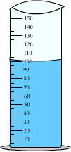
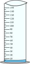
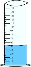
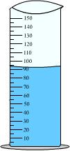
In an experiment to investigate what happens to run-off, a group of students set up three identical pans tilted at the same angle, Each pan had material attached to it. One had sponges attached to the surface, the other had paper towels attached and the third one had a plastic table cloth attached. (See the diagram below)
|
A
|
B
|
C
|
|
|
Initial volume of water
|
 |
 |
 |
|
The water from the cylinder is poured at the top of the pan and then collected at the bottom
|
 Pan with sponges Pan with sponges |
 Pan with paper towel Pan with paper towel |
 Pan with plastic Pan with plastic |
|
Final volume of water collected
|
 |
 |
 |
|
Conclusion |
|
|

|
© 2002 Alberta Online Consortium
|
Read pages 361 - 362
Lesson 6
Part 1
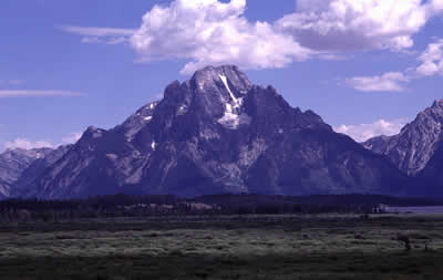
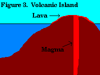
You will find the largest mountains and mountain ranges, not in Mount Everest in Nepal but in Hawaii. Mount Mauna Loa is the largest because it starts under the ocean. Visit this site to learn more
 |
 |
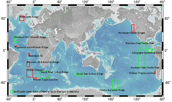
The map below shows some of the features of the ocean basin. These include ocean trenches such as the Marianas Trench in the Pacific Ocean that is over 11 kilometres deep. As well, there are abyssal plains, mid-ocean ridges, and sea mounts. In this part of the lesson, you will explore some of these features.
Waves, tides, and ocean currents cause shorelines to change constantly. Surface waves continue to move sediment back and forth. Waves shape shorelines by eroding and depositing sediments.
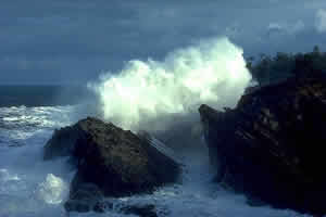
The tides also shape shorelines. Every day, tides raise and lower the place on the shoreline where surface waves erode and deposit sediments. The combination of waves and tides wear away the rocks to form hollows. Over time, these enlarge and become caves.
There are high tides and low tides each day. In some parts of the world, such as the coast of British Columbia and Alaska, there are two high tides and two low tides each day.
Rock fragments broken from the cliffs are carried by the endless motion of waves. They are transported as sediment by currents and act like sandpaper and aid in the erosion of the shore. Beaches are deposits of sediment made up of material of different sizes and shapes. In this part of the lesson, you will explore waves and tides and how they interact with the shoreline.
|
|

© 2002 Alberta Online Consortium
.
Lesson 7
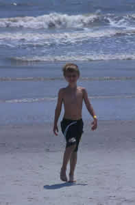
Have you ever been by a river after a heavy rain? The water is dirty and likely has logs and other debris floating in it. A river looks muddy when it has a lot of sediment and soil in it. Some of the soil comes from the riverbank itself while the rest is carried down by runoff.
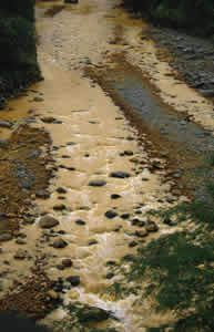
The surface of the Earth is constantly changing. Erosion is the process that wears away and moves the Earth's surface materials. The riverbank, in the photograph above, the land was eroded by the rainwater and the sediments are being transported to another area.
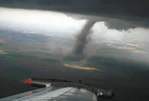
Gravity, glaciers, wind, and water all erode materials and carry them off. These agents only erode materials when they have enough energy of motion to do their work. When would the air cause erosion of topsoil-on a calm day or on a windy day? Obviously, it is on the windy day. Wind has the energy to wear away and transport dust, soil, and even rocks.
Take a look at the following pictures.
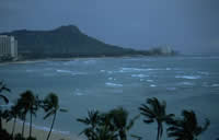
Where would you expect to see more erosion of the shoreline of an island in the ocean? On a day when there were waves crashing on the shore or on a calm day?
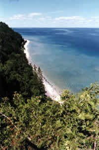
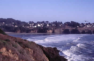
All agents of erosion deposit sediments they are carrying when their erosion energy decreases. This dropping of sediments is called deposition. Deposition is the final stage of the process of erosion. Sediments and rocks are deposited. Examine the following picture. What evidence do you see that sediments are being deposited?
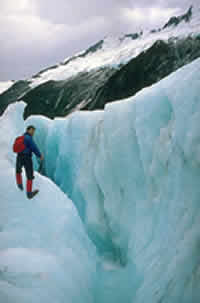
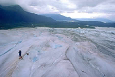
In this lesson, you will investigate one of the more spectacular agents of erosion-glaciers.
 |
 |
Exercise 2.3: Glacier Presentation
|
|

|
© 2002 Alberta Online Consortium
|
 Section 2 Notes
You have two options for your Section 2 Quiz - a multiple choice quiz or a written response quiz. You may choose to write the multiple choice or the written response. You only need to write one of them, so the choice is up to you! You are allowed to try both quizzes if you want, but it is not required.
The quiz attempt with the highest grade will be the one that is recorded on your report card.
The multiple choice quiz has 10 multiple choice, matching, and true/false questions. You have 15 minutes to complete it. As soon as the quiz submitted it will be auto-graded and you will receive a grade immediately.

Click the image above to start your quiz
The written response quiz has 5 short answer questions. Your responses must give a complete and detailed answer to the question. You have 20 minutes to complete the quiz. This quiz needs to be manually marked by your teacher, so you may have to wait a few days to get feedback and a grade.

Click the image above to start your quiz